Uttarakhand Hills Under Yellow Alert
Uttarakhand hills on high alert as IMD issues a yellow warning for heavy rain and strong winds up to 50 kmph. Snowfall is expected in five high‑altitude districts, including Dehradun, Uttarkashi, Rudraprayag, Chamoli, and Pithoragarh.

Dense clouds and early snowfall over the Himalayan districts of Uttarakhand; the state is under a yellow weather alert as the season takes a sharp wintry turn.|by AI
What’s happening in Uttarakhand?
Uttarakhand’s hill districts are bracing for another spell of unsettled weather. The India Meteorological Department (IMD) and the Uttarakhand Weather Monitoring Centre have issued a yellow alert for heavy rain across the higher reaches of the state, with wind speeds of up to 50 km per hour. At the same time, meteorologists are forecasting light snowfall in select high‑altitude areas, particularly districts above 2800 metres, including Dehradun, Uttarkashi, Rudraprayag, Chamoli, and Pithoragarh.
This weather change is being driven by a fresh western disturbance sweeping across North India, which is expected to remain active over the next 24–48 hours. The alert has prompted authorities to increase monitoring along riverbanks, hill roads, and sensitive tourist circuits, as rain‑induced landslides and localized flooding remain the main risks in the short term.
Why this weather change is happening
The present spell of rain, gusty winds, and possible snowfall in Uttarakhand is linked to a western disturbance moving across the northern plains and the Himalayan belt. Western disturbances are extratropical storm systems that originate over the Mediterranean and travel eastward, bringing moisture‑laden clouds into Jammu and Kashmir, Himachal Pradesh, and Uttarakhand.
When such a system reaches Uttarakhand, it interacts with the steep Himalayan slopes, forcing the moist air to rise rapidly. This leads to cloud formation, heavy precipitation, and sometimes thunderstorms. The higher the altitude, the more likely it is that rain turns into snow, especially when temperatures are already near the freezing point. IMD’s regional forecast indicates that the state’s upper Himalayan belt will see light to moderate rain, with the potential for snowfall above 2800 metres in the coming days.
Yellow alert: What it means for the hills
A yellow alert is the second level in IMD’s colour‑coded warning system, which goes from green (no warning) to yellow (watch), orange (alert), and red (take action). A yellow alert means that the weather is likely to be disruptive, but not extremely severe. It is a signal for residents, local administrations, and travellers to stay alert and make contingency plans if needed.
In Uttarakhand, the yellow alert currently covers districts like Dehradun, Nainital, Pauri, Uttarkashi, Chamoli, Rudraprayag, Bageshwar, Pithoragarh, and Tehri. The advisory warns of:
Light to moderate rain, especially in higher reaches.
Wind speeds of 40–50 km per hour, with gusts possibly touching 60 km per hour at higher altitudes.
Thunderstorms and lightning in some areas.
Reduced visibility and slippery roads due to rain and possible early snow.
Authorities have asked local administrations to keep an eye on river levels, check drains and culverts, and be ready with emergency response teams in case of landslides or flash floods.
Districts under watch: Where rain and snow are likely
Meteorological data and district‑wise forecasts show that the following five higher‑altitude districts are most likely to see rain‑to‑snow transitions or pure snowfall in the next 24–48 hours:
Uttarkashi
Areas above 2800 metres, including parts of Gangotri and Yamunotri routes, are likely to see light snowfall.
Lower‑lying regions around Uttarkashi town will experience heavy rain and gusty winds.
Chamoli
The Badrinath corridor and higher reaches such as Joshimath and nearby villages may receive light snow, especially at night.
The valley areas will see continuous rain, which can increase the risk of landslides along the Char Dham road corridors.
Rudraprayag
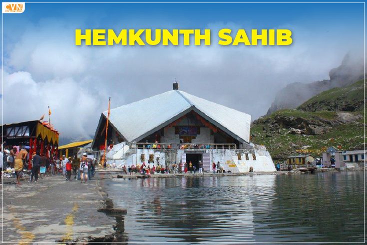
The Kedarnath region and higher altitudes are in the influence zone for possible snowfall.
The valley will experience rain and thunderstorms, with potential for localized flooding along the Mandakini and Alaknanda banks.
Bageshwar
Higher hill stations and remote areas may see light snow, while Bageshwar town and nearby low‑altitude regions will get rain and strong winds.
The Pindar and Goriganga river basins are being monitored for sudden water level changes.
Pithoragarh
The border‑region hilltops and high‑altitude passes like Dharchula and nearby peaks may see fresh snow cover.
Lower‑altitude areas will remain under heavy rain, which could affect border roads and mountain trails.
Dehradun, being at a relatively lower altitude, is forecast to receive rain and thunderstorms rather than snow, but the yellow alert still applies due to the risk of landslides on the surrounding hills and sudden waterlogging in the city.
Wind speeds up to 50 kmph: Risks and precautions
The forecast of 40–50 km per hour winds, with gusts up to 60 km per hour at higher altitudes, adds another layer of risk to this weather spell. Strong winds can:
Block roads due to uprooted trees, fallen branches, or downhill debris.
Damage weak structures, tin sheds, and temporary installations.
Disrupt power lines and telecom networks.
Make driving conditions treacherous on hill roads and hair‑pin bends.
Local authorities have advised:
Avoid unnecessary travel, especially on mountain roads and near cliff edges.
Secure loose hoardings, signboards, and rooftop items.
Motorcyclists and trekkers should postpone trips to higher altitudes until the weather stabilizes.
Pilgrims and tourists on Char Dham routes should stay updated with district administration advisories and follow local instructions.
Snowfall in the hills: Who will be affected?
Snowfall in Uttarakhand’s upper Himalayas affects multiple sectors and groups:
Pilgrims and tourists: The Char Dham routes (Yamunotri, Gangotri, Kedarnath, Badrinath) and popular trekking trails may see restricted movement or temporary closure. Snow‑covered roads can become slippery, and fog can reduce visibility to near zero.
Local residents: Higher‑altitude villages may face temporary isolation if roads are blocked by snow or landslides. Electricity and mobile connectivity can also be disrupted.
Agriculture and livestock: Sudden snowfall can damage winter crops and forage, affecting farmers and livestock owners in remote areas.
Transport and logistics: The Uttarkashi–Gangotri and Rudraprayag–Kedarnath routes, as well as several high‑altitude roads in Chamoli and Pithoragarh, are likely to see delays or short‑term closures.
District administrations have been asked to keep de‑icing equipment, snow ploughs, and emergency response teams ready so that essential traffic and rescue operations can continue without major disruption.
Authorities’ preparedness and public advisories
In response to the IMD forecast and the state weather alert, Uttarakhand’s disaster management and local agencies have taken several precautionary steps:
District administrations have been directed to inspect riverbanks, check dams, and embankments, and to keep emergency warehouses stocked with essential supplies.
Traffic and highways departments are monitoring key hill routes, including the Char Dham highway and sensitive passes, and may impose temporary bans or restrictions if conditions worsen.
Fire and rescue services are on high alert to respond to landslides, flooding, or isolated incidents caused by strong winds or lightning.
Health departments are instructed to ensure medicines, blankets, and basic medical aid are available in remote high‑altitude blocks.
The public is being advised to:
Stay indoors during heavy rain and thunderstorms.
Avoid venturing near rivers, gorges, and landslide‑prone slopes.
Follow local radio, district control rooms, and official social media handles for real‑time updates.
Keep emergency numbers handy and be prepared for short‑term power outages.
How this compares to past weather spells in Uttarakhand
Uttarakhand has a long history of weather‑related alerts during the winter and early spring months, especially when western disturbances intensify. In previous years:
Yellow and orange alerts for rain and snow have often led to temporary road closures and delays in pilgrimage traffic.
At times, unseasonal heavy rain has triggered flash floods and landslides in the fragile Himalayan terrain, underscoring the need for strict compliance with weather advisories.
This latest alert is part of the same pattern: a combination of heavy rain, strong winds, and early snowfall in the upper Himalayas. The state’s improved early‑warning systems and communication networks now allow for more timely alerts and, in theory, better preparedness than in the past.
What travellers and residents should do now
For anyone planning to visit or already travelling in Uttarakhand’s hills, here are some practical steps to minimize risk:
Check official alerts daily on IMD and Uttarakhand State Disaster Management Authority (SDMA) portals.
Postpone high‑altitude trips if you are heading to areas around Yamunotri, Gangotri, Kedarnath, Badrinath, or any pass above 2800 metres.
If already in the hills, avoid night‑driving or trekking, stay in well‑connected accommodations, and keep an emergency kit with warm clothes, food, water, and a torch.
Follow local instructions from police, transport officials, and forest departments.
Keep communication channels open by charging power banks and keeping mobile networks active.
Residents of hill towns should also inspect drainage systems around their homes, clear clogged gutters, and secure loose outdoor items to prevent wind‑related damage.
Looking ahead: What can be expected next
Meteorologists expect the current western disturbance to gradually weaken over the next 36–48 hours. The yellow alert may be downgraded or lifted once the system moves further east, but light rain and scattered snowfall can linger in higher altitudes for a few more days.
Temperatures in the hills are likely to drop further, especially after rainfall or snowfall, leading to a sharper feeling of cold and possible fog in the mornings. This will extend the window when snow patches remain on roads and trails, so drivers and trekkers will need to use extra caution even after the alert is relaxed.
Summary and key takeaway
Uttarakhand’s hill districts are currently under a yellow weather alert due to heavy rain, strong winds up to 50 km per hour, and the possibility of light snowfall in five high‑altitude districts: Dehradun, Uttarkashi, Chamoli, Rudraprayag, Bageshwar, and Pithoragarh. The alert is a precautionary measure issued by IMD and the state’s weather monitoring system, triggered by a western disturbance over North India.
Residents, tourists, and pilgrims are advised to stay updated, avoid high‑altitude routes when possible, secure property against wind damage, and follow all official advisories. With proper preparedness and timely response, the state aims to minimize disruptions and keep people safe during this spell of wintry weather in the Himalayan region.
for in depth and in hindi click here
read more here