The IMD has forecast isolated rain in Konkan, moderate to heavy rains in Madhya Maharashtra and thunderstorm with lightning in Marathwada in next few days. The weather change is critical for farming, water storage and daily life around the state.
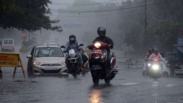
Dark monsoon clouds gather over Maharashtra as the India Meteorological Department forecasts rainfall. This image is only for illustration.
Maharashtra is set for a wetter spell as the southwest monsoon continues to advance across the state, with the India Meteorological Department forecasting rain until June 26 in Konkan, Madhya Maharashtra and Marathwada. The weather system has already moved towards Pune and Raigad, and conditions are becoming favorable for further progress in Mumbai and other parts of the state. The forecast points to isolated rainfall in Konkan, thunderstorms with lightning and winds in Madhya Maharashtra, and light to moderate showers in Marathwada over the coming days.
Why the Monsoon Is Advancing Now
The monsoon is moving ahead because atmospheric conditions are becoming more supportive across western and central Maharashtra. In simple terms, the air circulation, moisture levels and regional wind patterns are aligning in a way that allows rain-bearing systems to push inland. This is usually how monsoon progression works: once the moisture flow strengthens and the environment becomes unstable enough, rain spreads from coastal areas into the interior parts of the state. The Hindu has covered the full story.
For Konkan, the forecast of isolated rainfall from June 22 to June 26 suggests that the coastal belt will continue to receive on-and-off showers rather than a completely uniform rain event. In Madhya Maharashtra, the situation looks stronger, with thunderstorms, lightning, winds and moderate to heavy rainfall expected over the same period. Marathwada is likely to get thunderstorms with lightning and light to moderate rain between June 22 and June 24, which could bring some relief but may not be enough to fully replenish water stress in all districts.
This kind of pattern is not unusual in early monsoon phases. The rain does not always arrive everywhere at once. Instead, it builds in stages, often beginning in coastal belts like Konkan before moving deeper into the state. That makes the current forecast especially important for district-level planning.
What the Forecast Says
According to the IMD outlook, Maharashtra will see rainfall activity across three key regions through June 26:
Konkan: Isolated rainfall likely from June 22 to June 26.
Madhya Maharashtra: Thunderstorms with lightning, gusty winds and moderate to heavy rain are expected during the same period.
Marathwada: Thunderstorms with lightning, winds and light to moderate rainfall from June 22 to June 24.
This forecast is significant because it covers not just one region but a broad stretch of the state. For people living in coastal districts, rain may be intermittent but persistent. For residents in the interior, especially in rain-dependent agricultural zones, even a few days of good showers can make a noticeable difference.
The mention of winds and lightning is also important. Rainy weather is not only about water supply and crop support; it can also bring travel disruption, temporary power cuts and local safety risks. So while the monsoon is a welcome development, it also requires caution.
Background and Context
Maharashtra depends heavily on the southwest monsoon for agriculture, drinking water storage and seasonal cooling. In many districts, the first meaningful monsoon rains are watched very closely because they determine how quickly sowing can begin. Konkan usually sees the earliest and heaviest impact because of its coastal location, while Madhya Maharashtra and Marathwada often receive more variable rainfall.
This year’s progress matters even more because monsoon timing has been closely watched after recent concerns around delayed or uneven rainfall in parts of the state. When the monsoon advances into Pune, Raigad and eventually Mumbai, it is usually seen as a sign that the broader weather system is settling in. That is why the IMD’s forecast is being followed closely not just by residents, but by farmers, civic authorities and transport planners.
The last few days also matter from a water-security point of view. Maharashtra’s reservoirs and city supply systems rely heavily on rain-fed recharge. So when the monsoon picks up, it can improve the outlook for both urban water supply and agricultural planning. Yeh issue kaafi important hai because rainfall in Maharashtra affects much more than just the weather outside your window.
Timeline
June 22, 2026: IMD forecasts rain and thunderstorms across Konkan, Madhya Maharashtra and Marathwada.
June 22 to June 24: Marathwada is expected to receive thunderstorms, lightning, winds and light to moderate rain.
June 22 to June 26: Konkan is likely to see isolated rainfall.
June 22 to June 26: Madhya Maharashtra is forecast to experience thunderstorms with lightning, winds and moderate to heavy showers.
By June 26: The monsoon may progress further into Mumbai and other parts of Maharashtra if conditions remain favorable.
Why This Matters
This matters because the monsoon is not just a weather event in Maharashtra; it is a lifeline. It influences crop sowing, groundwater recharge, reservoir inflows, city water management and even daily transport. When rain comes at the right time and in the right amount, it helps both urban and rural communities.
For farmers, the forecast can decide whether to begin sowing, wait for a few more days, or prepare land for the first major showers. For cities, especially in regions like Mumbai and Pune, rainfall can change traffic patterns, drainage load and local water availability. In short, the coming rain has practical consequences, not just symbolic ones.
It also matters because thunderstorms with lightning and gusty winds can be disruptive. While moderate rain is welcome, intense weather can create risks for road users, small traders, construction activity and electricity infrastructure. That means people need to stay alert even as they welcome the monsoon.
India Angle
For Indian readers, especially those in Maharashtra, this is a very relevant update because monsoon timing shapes ordinary life in a very direct way. In Hinglish, seedhi baat yeh hai: jab barsaat aati hai, toh farmers khush hote hain, but city folks also need to prepare for traffic, waterlogging aur power issues.
Mumbai’s progress matters nationally too because the city is one of India’s biggest urban centers. When the monsoon advances there, it is often treated as a sign that the seasonal rain system is strengthening across western India. Pune, Raigad and Konkan are also high-interest regions because they sit at the intersection of weather, water supply and economic activity.
For people watching weather updates in India, this forecast is the kind that affects real planning. Whether it is office travel, school schedules, construction work or farming, the next few days could bring changes that need attention.
Reported Weather Outlook
An IMD-style outlook would typically suggest that atmospheric instability, moisture influx and wind patterns are supporting rainfall progression across the state. In practical terms, that means the monsoon system is active enough to produce showers in several places, but still uneven enough to make some districts wetter than others.
Weather experts usually caution that thunderstorms with lightning require special care, even when rainfall is welcome. Gusty winds can bring down branches, affect visibility and create short-lived but sharp local disruptions. That is why residents are advised to keep an eye on updated district-level forecasts rather than rely only on the broad state outlook.
Analysis
My opinion is that this forecast is reassuring overall, but the details matter. Rain is finally advancing, which is good news for the state, but the presence of thunderstorms and lightning means the weather is not calm or uniform. That is why readers should take the forecast seriously, especially in rural areas and on busy city roads.
The broader takeaway is that monsoon news in India is never just about rainfall totals. It is about timing, spread and consistency. A few days of good rain can make a huge difference if it reaches the right areas, and Maharashtra appears to be entering that phase now.
What Next
Over the next few days, the key thing to watch will be whether the monsoon continues pushing into Mumbai and other interior regions. If the weather systems remain favorable, Maharashtra could see broader and more regular rainfall by the end of the month.
Residents should expect changing conditions, including sudden showers, thunderstorms and brief wind events. Farmers may use this period to prepare fields, while city authorities may monitor drainage and transport systems more closely. If rainfall becomes steadier, it could improve water availability and support the seasonal cycle more confidently.
The forecast will likely be updated again as the monsoon advances. For now, Maharashtra is clearly moving into a more active rain phase, which is good news after a period of uncertainty.
Conclusion
The IMD’s forecast of rain until June 26 shows that the monsoon is now advancing across Maharashtra, with Konkan, Madhya Maharashtra and Marathwada all set for varying degrees of rainfall and thunderstorms. Pune and Raigad are already seeing progress, and conditions are turning favorable for further movement into Mumbai and other parts of the state. For farmers, city residents and water managers alike, this is a welcome but important weather shift that deserves close attention.
Written By A. Jack